DEDHAM, Mass — Winter storm, high wind, and coastal flood warnings have been issued in Massachusetts ahead of a powerful nor’easter that’s expected to dump heavy snow, knock out power with strong wind gusts, and threaten the coast with flooding.
A winter storm warning is in effect for central Middlesex, eastern Essex, eastern Norfolk, southeast Middlesex, southern Worcester, Suffolk, western Essex, western Norfolk, eastern Plymouth, northern Bristol, southern Bristol, southern Plymouth, western Plymouth, Barnstable, Dukes, and Nantucket counties from 1 a.m. Tuesday through 1 a.m. Wednesday, according to the National Weather Service.
Heavy of snow is possible for parts of the Bay State, except for the South Coast, Cape Cod, and the Islands.
“Travel could be very difficult to impossible with snowfall rates of 1 to 2 inches per hour at times,” the NWS said in a statement. “Areas of blowing snow could significantly reduce visibility. The hazardous conditions will particularly impact the Tuesday morning commute.”
In addition to the warnings, NWS issued a winter weather advisory for western Franklin, western Hampshire, eastern Franklin, eastern Hampden, eastern Hampshire, northern Worcester, northwest Middlesex, western Hampden, and southern Berkshire counties from 1 a.m. Tuesday through 1 a.m. Wednesday.
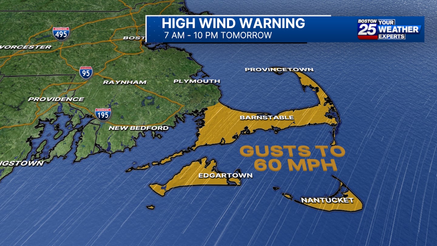
The NWS has also issued a high wind warning for Cape Cod and the Islands.
The warning is in effect for Barnstable, Dukes, and Nantucket counties from 7 a.m. to 10 p.m. Tuesday. Gusts of up to 60 mph are possible in the impacted areas.
“Damaging winds could blow down trees and power lines. Power outages are possible. Travel could be difficult, especially for high-profile vehicles,” the NWS said in a statement.
The strongest winds occur approximately between 1 p.m. and 7 p.m.
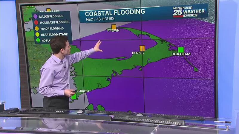
Towns and cities along the coast of Massachusetts are also bracing for flooding.
A coastal flooding warning is in effect for Barnstable, Dukes, Norfolk, Plymouth, Nantucket, Eastern Essex, and Suffolk counties from noon to 5 p.m. on Tuesday.
In a statement, the NWS said, “Some vulnerable coastal roads become impassable around high tide. Flooding 1 to 2 feet deep affects some coastal roads and low-lying areas from Revere and Winthrop through Boston to Hull, Braintree, and Quincy. Splashover and debris may wash onto coastal roads when large waves occur. Roads remain passable. Low-lying areas and roads near Nantucket Harbor, including Easy Street, may experience pockets of shallow flooding less than one foot deep. Roads remain passable. Shallow pockets of flooding less than one foot deep affect low-lying areas in Provincetown, mainly near the airport and Race Point Road. In Truro, flooding up to one foot deep affects low-lying areas near Pamet Harbor and along the Pamet River. Roads remain passable with pockets of shallow flooding less than one foot deep. This mainly affects low-lying areas and roads near Edgartown Harbor, including the Chappy Ferry Dock. Shallow flooding may also approach Five Corners in Vineyard Haven.”
Stay with the Boston 25 Weather Team for updates as the storm forms and gets closer.
This is a developing story. Check back for updates as more information becomes available.
Download the FREE Boston 25 News app for breaking news alerts.
Follow Boston 25 News on Facebook and Twitter. | Watch Boston 25 News NOW
©2024 Cox Media Group
/cloudfront-us-east-1.images.arcpublishing.com/cmg/7QOJU3BNCJERBNKJC5LWTBYFLU.png)


