DEDHAM, Mass. — We’re tracking another winter storm that’s expected to bring a messy mix of snow, sleet, ice, and rain to Massachusetts.
The Boston 25 Weather Team has issued a Weather Alert for possible dangerous travel beginning Thursday evening.
The National Weather Service has issued a winter weather advisory for Berkshire, Franklin, Middlesex, Essex, Hampshire, Hampden, Norfolk, Suffolk, and Worcester counties from 5 p.m. Thursday until noon on Friday.
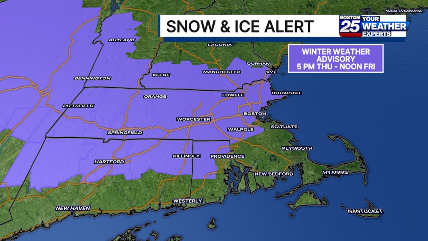
“Plan on slippery road conditions,” the National Weather Service warned in the advisory. “Slow down and use caution while traveling.”
Starting after 10 a.m., there’s a chance of low-impact drizzle or spot showers, leading to wet roads, but the problems don’t roll in until around the evening commute.
Roads in central Massachusetts and the Merrimack Valley could start getting icy by around 5 p.m. as freezing rain, sleet, and snow work into the region.
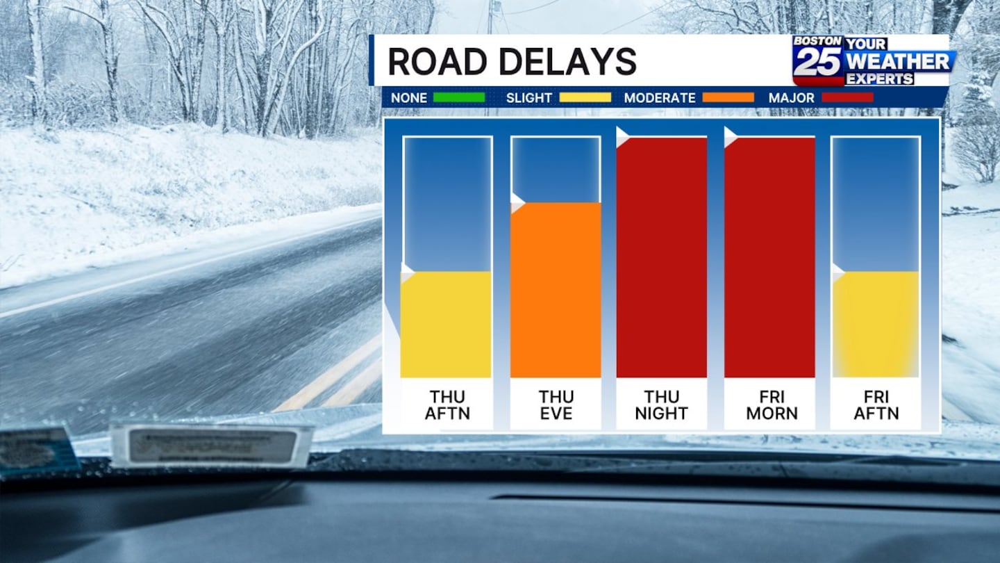
Boston 25 Chief Meteorologist Shiri Spear said in her latest forecast that drivers should prepare for major road delays on Thursday night and Friday morning as conditions peak.
“The main event, with the heaviest precipitation, happens tonight,” Spear said. “So, overnight tonight, into tomorrow morning, especially north and west of Boston, we’ve got a mix of snow, sleet, and freezing rain.”
The Massachusetts Emergency Management Agency added, “If you’re going to be on the roads tonight or Friday morning, be careful of potential icy conditions. Leave extra time to reach your destination and extra space between you and the driver in front of you.”
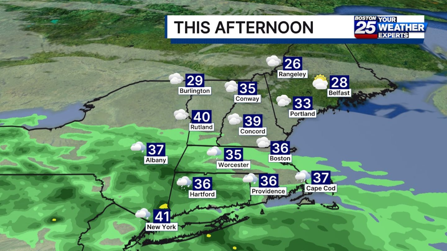
Southeastern Massachusetts is expected to see plain rain.
A snow and sleet map issued by the Boston 25 Weather Team shows the potential for up 5 inches of accumulation in isolated areas, with a widespread coating to 3 inches possible for some.
“Everyone gets excited for the snow map. I’d say the snow map for many of you isn’t going to be the biggest part of this storm,” Spear said.
Boston northward could get 1 to 3 inches. Parts of the North Shore, the Seacoast, and the Massachusetts-New Hampshire border could get 3 to 5 inches of snow. Along and south of the Mass. Pike will likely only see up to 1 inch of snow, as freezing rain or rain will be more prevalent.
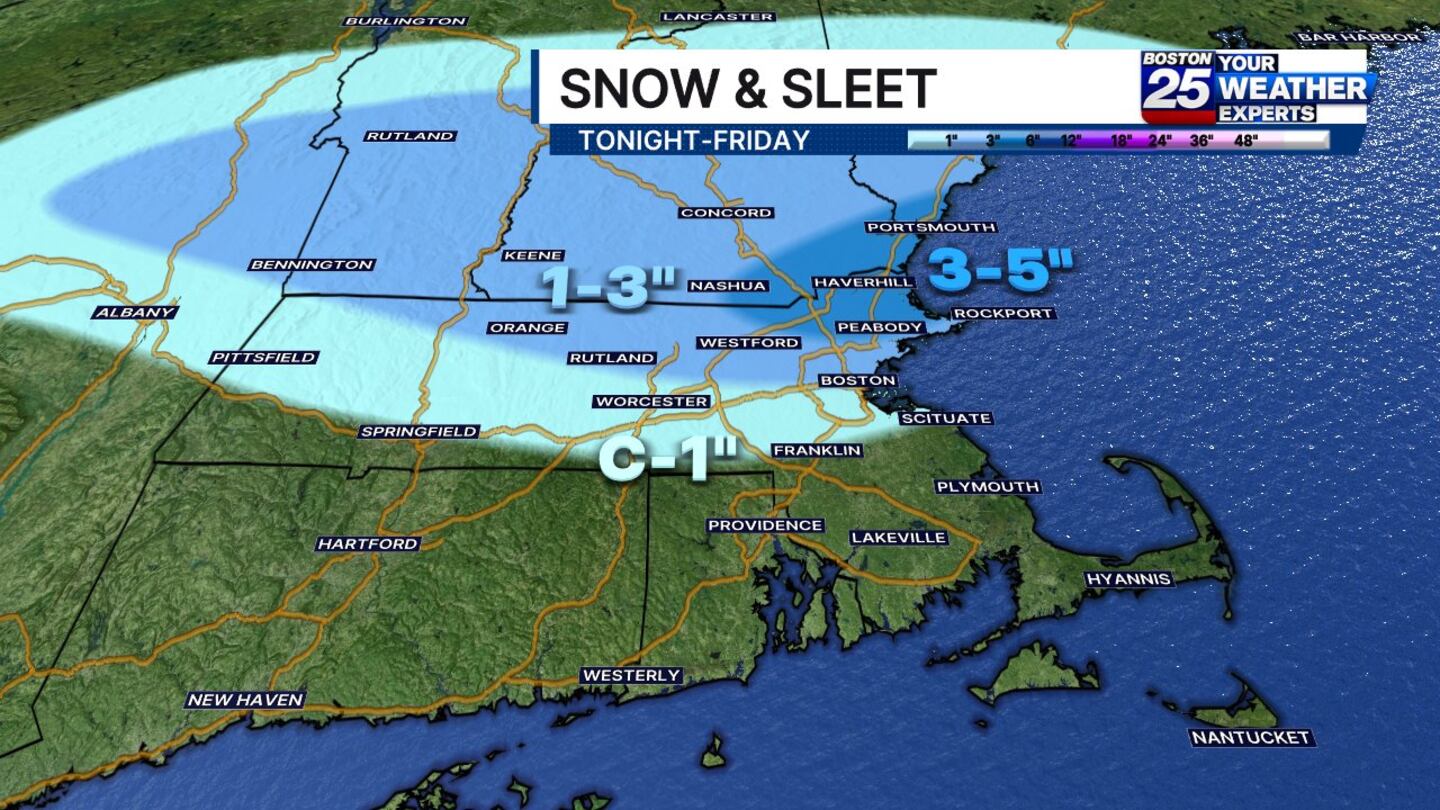
Icing potential from this storm is also a major concern, with up to 0.2 inches in parts of Worcester County and the Berkshires.
“It may not sound like a lot, but that’s actually quite a bit of ice,” Spear said. “That’s going to lead to some slippery travel concerns.”
This storm is expected to taper off between 7 a.m. and 10 a.m. Friday.
A similar storm caused slick travel and crashes across the state on Tuesday night into Wednesday morning.

After this dose of winter, a milder pattern will settle in, with temperatures climbing into the 50s on Sunday.
The middle of next week could bring a warmup into the mid-60s.
For the latest forecast updates, visit the Boston 25 Weather page.
Download the FREE Boston 25 News app for breaking news alerts.
Follow Boston 25 News on Facebook and Twitter. | Watch Boston 25 News NOW
©2026 Cox Media Group
/cloudfront-us-east-1.images.arcpublishing.com/cmg/7QOJU3BNCJERBNKJC5LWTBYFLU.png)


