Winter storm and coastal flood watches are in effect ahead of a weekend nor’easter that’s expected to impact parts of Massachusetts.
The winter storm watch is in effect for Barnstable, Dukes, and Nantucket counties from late Saturday night through late Sunday night.
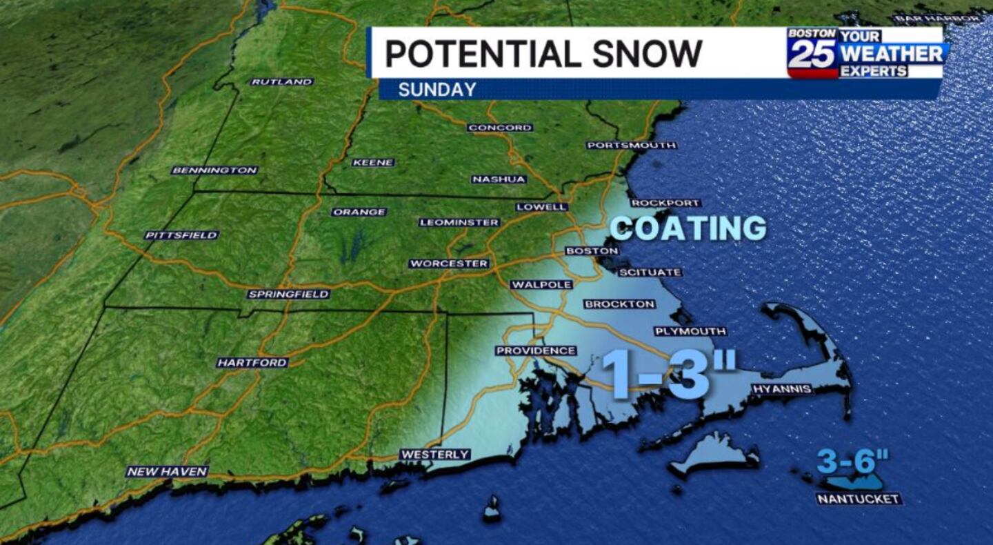
Since the storm is projected to move north on a track that pushes it farther offshore, snow totals are expected to be on the lower side.
“It’s going to be a miss, but we will have some backlash,” Boston 25 Meteorologist David Bagley said in his Friday afternoon forecast.
The Boston 25 Weather team is predicting snow accumulations of 3 to 6 inches in the areas under the watch. Points along the South Shore could see 1 to 3 inches of snow.
"Travel could be very difficult. Gusty winds could bringdown tree branches," the National Weather Service warned in the winter storm watch.
In addition to the possibility of more snow on top of last week’s major snowstorm, the nor’easter is expected to bring flooding concerns to communities along the coast.
A coastal flood watch is in effect for Eastern Essex, Suffolk, Eastern Norfolk, Eastern Plymouth, Barnstable, Dukes, and Nantucket counties from Sunday morning through Monday afternoon.
“Expect at least shallow flooding less than one foot deep along much of the eastern Massachusetts coastline, resulting in temporary closure of more vulnerable coastal roads around high tide Sunday morning, Sunday evening, and midday Monday,” the NWS warned. “Moderate flooding, should it occur, is more
likely along the Bay side of Cape Cod, in Nantucket Harbor, and
in Edgartown, Vineyard Haven, and Oak Bluffs on Marthas
Vineyard."
For the latest forecast updates, visit the Boston 25 Weather pageand download the Boston 25 Weather app.
Download the FREE Boston 25 News app for breaking news alerts.
Follow Boston 25 News on Facebook and Twitter. | Watch Boston 25 News NOW
©2026 Cox Media Group
/cloudfront-us-east-1.images.arcpublishing.com/cmg/7QOJU3BNCJERBNKJC5LWTBYFLU.png)


