DEDHAM, Mass. — Plowable snow is expected in Massachusetts on Wednesday, marking the first of three possible winter storms in the coming days.
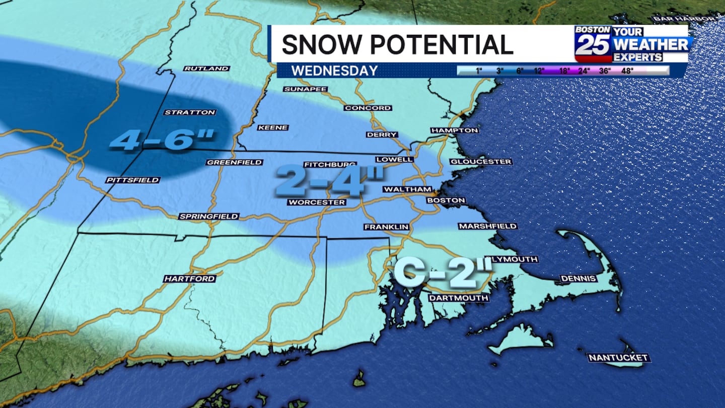
A new snow map issued by the Boston 25 Weather team on Tuesday afternoon showed the potential for up to 6 inches of snow in some areas, with a widespread 4 inches of snow on tap.
Points in the northernmost area of western Massachusetts could see 4 to 6 inches of snow. Most other areas will see 2 to 4 inches of snow, with the exception of southeastern Massachusetts, where a coating to 2 inches of snow is likely.
The biggest travel impacts will be on Wednesday afternoon and night, when precipitation will be heavier. After dark, the rain will start to turn to straight snow.
“I think by 5 p.m., you’re probably going to see a mix of rain and snow. I don’t think there’s going to be a ton of sticking. But it could start right around the time of the evening commute,” Spear said of Wednesday’s forecast. “Most of the accumulation is going to happen during the overnight hours when it’s slightly cooler.”
A winter weather advisory has also been issued in Massachusetts.
The snowfall is expected to be over by the time we wake up on Thursday morning.
This isn’t the only storm the Boston 25 Weather team is tracking. A Friday night into Saturday will bring a chance for a second storm, and a third storm chance comes Sunday night into Monday.
In addition to Wednesday, Weather Alerts have been issued for Friday and Monday, but specific storm details for those days have not yet become clear.
The Boston 25 Weather team will continue to monitor the forecast and provide updates on potential Friday and weekend snow totals as this week develops.
For the latest forecast, visit the Boston 25 Weather page.
Download the FREE Boston 25 News app for breaking news alerts.
Follow Boston 25 News on Facebook and Twitter. | Watch Boston 25 News NOW
©2026 Cox Media Group
/cloudfront-us-east-1.images.arcpublishing.com/cmg/7QOJU3BNCJERBNKJC5LWTBYFLU.png)


