
With the final day of February comes the final day of meteorological winter. Let’s take a look back at all of the cold and snow we faced.
DECEMBER 2025
Average Temperature: 31.3F (4.4F colder than average)
Total Snowfall: 4.3″ (4.7″ less than average)
December continued a stretch of relatively cool weather from the end of fall. Similar to last year however, it left many wondering if we were going to face another cold and DRY winter, as snow underwhelmed. Our biggest snowfall came a day after Christmas, but just 2.9″ fell.
JANUARY 2026
Average Temperature: 28.0F (2.0F colder than average)
Total Snowfall: 29.8″ (15.5″ more than average)
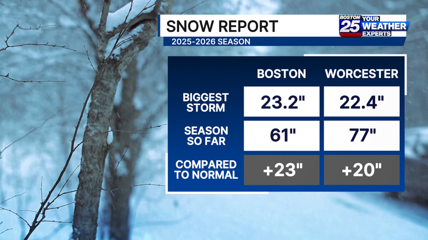
January was a fairly uneventful month for the most part. It began quite chilly, but we also tallied four 50-degree highs. Boston’s greatest snowfall heading into the final week of the month was just 5.3″. That all changed abruptly when an atypical snowstorm dumped 23.2″ on the city of Boston and much of the area! Not only was it the 8th largest storm by snowfall, but it also ended the 2nd longest 6″ snowfall drought! Temps became decisively colder in the following weeks.
FEBRUARY 2026 (Through 2/26)
Average Temperature: 28.1F (3.7F colder than average)
Total Snowfall: 26.8″ (12.4″ more than average)
It took until the 11th for Boston to record it’s first warmer than average day and we’ll finish this month with only five days reaching 40 degrees! Of course, this one will be remembered for the blizzard of 2026, which officially dumped 17.1″ of snow in Boston, but hammered SE Mass and Rhode Island with 24-36″ of snow! It was our first true blizzard in four years and officially pushed our season snowfall to the highest mark since the infamous 2014-2015 season.
Download the FREE Boston 25 News app for breaking news alerts.
Follow Boston 25 News on Facebook and Twitter. | Watch Boston 25 News NOW
©2026 Cox Media Group
/cloudfront-us-east-1.images.arcpublishing.com/cmg/7QOJU3BNCJERBNKJC5LWTBYFLU.png)


