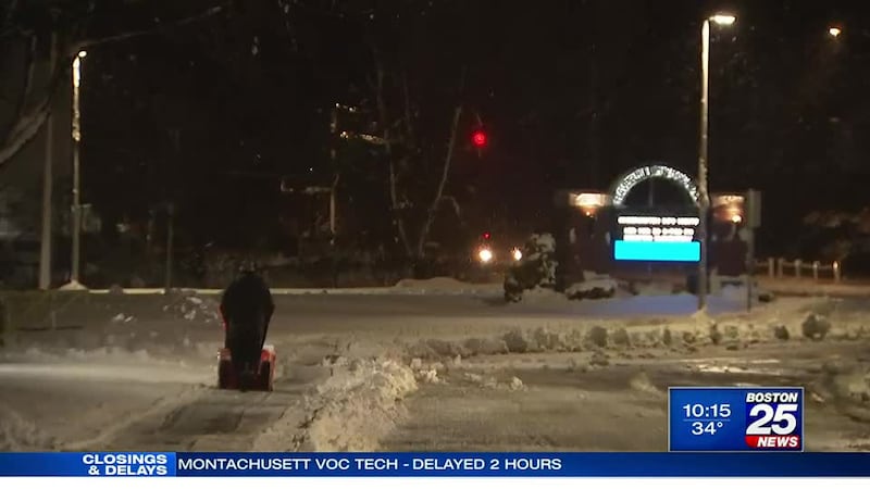
BOSTON, Mass. — A winter storm warning is in effect in Massachusetts due to a multiday nor’easter that is expected to dump snow across the state through early Wednesday morning.
The storm has already dumped more than two feet of snow in some areas. As of 11 p.m. Tuesday, there were just over 33,000 power outages.
Snow began piling up in Western and Central Massachusetts late Monday into early Tuesday, while Eastern Massachusetts saw drenching rain. The rain-to-snow shift in Eastern Massachusetts happened after 12 p.m. Snow is expected through the afternoon and evening.
That rain/snow line moving eastward across the Merrimack Valley. Expect the snow to stick quickly once it gets to your town. @boston25 #mawx pic.twitter.com/W2kjDgUR54
— Shiri Spear (@ShiriSpear) March 14, 2023
Northern Worcester, Eastern Franklin, Northwest Middlesex, Central Middlesex, Southern Worcester, Western Essex, Western Franklin, Western Hampden, Western Hampshire, Northern Berkshire, Southern Berkshire, Eastern Essex, Northern Bristol, Southeast Middlesex, Suffolk, Eastern Hampden, and Eastern Hampshire counties are all under a winter storm warning through 8 p.m. Wednesday.
Eastern Norfolk, Eastern Plymouth, Northern Bristol, Southern Bristol, Southern Plymouth, Western Norfolk, and Western Plymouth are all under winter weather advisories.
Here's the wide view of the #snowmap that goes ALL DAY & NIGHT. Send in your reports & photos to us @boston25! pic.twitter.com/DVPOZBQzcn
— Shiri Spear (@ShiriSpear) March 14, 2023
Points along the North Shores saw between 4 to 8 inches of snow. As of 11:00 p..m., Haverhill boasted the highest snow total with 8 inches.
Haverhill Public Schools apologized to families Tuesday evening, saying it made a bad call and probably should have canceled school.
Unlike some inland communities, the focus in Lynn was on the waves- high, arching, and battering the cold shores.
As of Tuesday evening, the Boston area was battered with more rain and slick conditions than it was snow. Thick flakes finally started to fall around 10:00 p.m.
Starting to snow in Boston. #MAWX #Boston25 pic.twitter.com/Qf4jUvVOJj
— Adam Liberatore (@bostonTVguy) March 15, 2023
Commuters in and out of Boston told Robert Goulston that conditions were treacherous.
Worcester was buried under 12 inches of snow, while some Worcester County towns at a higher elevation, like Princeton, were dumped with over 25 inches of powder.
Many town operations in Worcester were put on pause Tuesday evening as the city dug itself out.
Rain, strong wind gusts, and coastal flooding was also a concern with this powerful storm. Scattered showers and snow showers began Monday afternoon. The height of the storm battered the region throughout the day Tuesday.
“Travel could be very difficult to impossible. The hazardous conditions will impact both the morning and evening commutes on Tuesday. Gusty winds could bring down tree branches,” the National Weather Service said in an advisory.
This storm is packing a ton of moisture, which will lead to significant heavy and wet snow for the elevations and heavy rain closer to the coast initially.
A high wind warning has been issued for Eastern Essex, Eastern Norfolk, Eastern Plymouth, Suffolk, Barnstable, Dukes, and Nantucket counties through Wednesday afternoon.
Stronger wind gusts up to 60 mph will lead to power outage concerns, especially with heavy and wet snow weighing down on powerlines and trees in the elevations.
Boston 25 News Meteorologist Jason Brewer reported that towns like Scituate will not see relief from wind gusts of 60 miles per hour until roughly midnight.
“People should avoid being outside in forested areas and around trees and branches. If possible, remain in the lower levels of your home during the windstorm, and avoid windows. Use caution if you must drive,” the NWS said.
Barnstable, Eastern Essex, Eastern Norfolk, Eastern Plymouth, and Suffolk are also under coastal flood watches.
“Flooding is up to one foot deep and affects more vulnerable shore roads, including Morrissey Boulevard in Boston,” the NWS said. “Large waves may produce pockets of moderate flooding along the ocean shoreline in places such as Gloucester, Revere, Hull, and Scituate. Flooding could be 1 to 2 feet deep in some locations and debris could wash onto coastal roadways. Significant beach erosion is also possible.”
Nantucket is under a coastal flood advisory.
“Up to one foot of inundation above ground level expected in low-lying areas near shorelines and tidal waterways.” the NWS said.
For more on the storm, visit the Boston 25 Weather page.
This is a developing story. Check back for updates as more information becomes available.
Download the FREE Boston 25 News app for breaking news alerts.
Follow Boston 25 News on Facebook and Twitter. | Watch Boston 25 News NOW
©2023 Cox Media Group


