DEDHAM, Mass. — Parts of Massachusetts are under a flood watch due to an “absolute soaker” of a weather system that could dump several inches of rain.
The watch is in effect for Worcester, Franklin, Hampshire, Hampden, and Berkshire counties through Wednesday night, according to the National Weather Service.
Vermont, New Hampshire, Connecticut, Rhode Island, and eastern New York are also included in the watch.
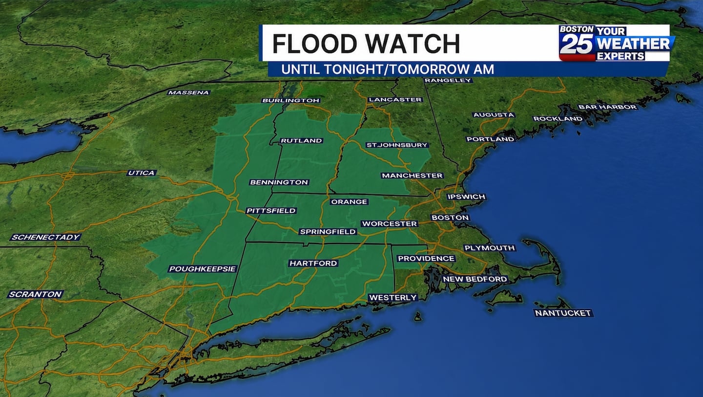
“Excessive runoff may result in flooding of rivers, creeks, streams, and other low-lying and flood-prone locations,” the NWS wrote in its watch alert. Flooding may occur in poor drainage and urban areas.”
The NWS added, "Those living in areas prone to flooding should be prepared to take action should flooding develop."
Boston 25 Chief Meteorologist Shiri Spear said a widespread 1 to 4 inches of rain is likely, with localized totals up to 7 inches in elevated areas.
Torrential rain is on the way today - greatest impacts this afernoon in the greater #Boston area. @boston25 #mawx #newengland pic.twitter.com/U0PuvjGFNp
— Shiri Spear (@ShiriSpear) July 29, 2026
The rainfall is expected to peak midday into the afternoon, with occasional torrential downpours limiting visibility on the roads. There is also the possibility of thunderstorms and damaging wind gusts.
“Be ready for locally flooded roads and slowdowns midday, afternoon, and evening with the heaviest rain,” Spear wrote in her Wednesday weather blog.
Worcester will likely see rain by midmorning, with Boston and points south of the Massachusetts Turnpike getting a soaking by lunch.
While a flood watch has not yet been issued for eastern Massachusetts, heavy rain will be a concern through the evening commute, according to Spear.
For updates on the forecast, visit the Boston 25 Weather page.
Download the FREE Boston 25 News app for breaking news alerts.
Follow Boston 25 News on Facebook and Twitter. | Watch Boston 25 News NOW
©2026 Cox Media Group
/cloudfront-us-east-1.images.arcpublishing.com/cmg/7QOJU3BNCJERBNKJC5LWTBYFLU.png)


