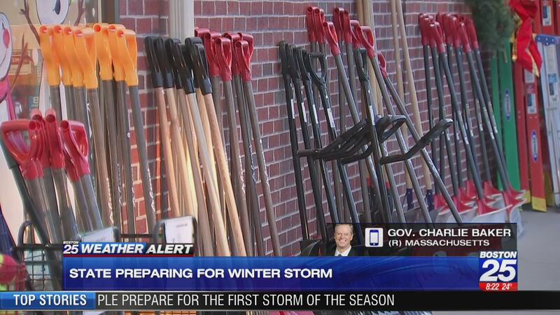
A burst of heavy snow is blanketing Massachusetts with significant impacts to the Tuesday morning commute.
The heaviest snow should land between 4 and 10 a.m. with several more inches of accumulation expected as heavy bands move through. Most of the state is under either a Winter Storm Watch or a Winter Storm Warning until Tuesday morning.
Looking ahead, here's what we see for additional snow. I'll update this throughout the morning as heavy bands shift eastward! @boston25 pic.twitter.com/20YBJ9auo2
— Shiri Spear (@ShiriSpear) December 3, 2019
Hundreds of schools are also closed for the day and some towns are delaying start times for workers.
Related: Photos: Boston 25 Viewers enjoy December's first snowfall
Related: Officials warn of hazardous travel conditions due to storm
The highest snow totals are expected to come from the inland communities while coastal towns will see more of a wintry mix, keeping totals on the lower end.
>>>MORE: Tracking a Winter Storm | MassDOT tips on driving in snowy and wintry conditions
Forecast | Download our free apps | Weather alerts | School closings & delays | Snow totals
WATCH BOSTON 25 NEWS
Kevin Lemanowicz | Shiri Spear | Vicki Graf | Jason Brewer
Follow Boston 25 News on Facebook | Twitter | Instagram
Service on the Orange Line is
due to a "power problem" at State Street, the MBTA said on Twitter. Riders can use the Green Line to get to around downtown.
The speed limit on the Mass. Pike has been lowered to
. Restrictions on tandem tractor-trailers and special permit vehicles are also in place from the New York border to the I-495 interchange.
A look at the drive along 495 South near the Xfinity Center. Slushy roads. Steady speeds. Remember, don’t crowd the plow. Live reports this a.m. @boston25 pic.twitter.com/JhxGuz2O2G
— Joy Dumandan (@JoyDumandanTV) December 3, 2019
MassDOT is asking drivers to take it slow this morning. The HOV lane into Boston will not be open for the morning commute
Drivers are encouraged to stay off the road if they can.
— MEMA (@MassEMA) December 3, 2019
If you must travel during #MAsnow today, clear snow off your vehicle, maintain a safe distance, take it slow, give yourself extra time & #DontCrowdThePlow.
Safe Winter Driving Tips: https://t.co/eR0zuCQECO pic.twitter.com/BBsIFm8LNt
Heavy snow is falling across the state as the latest round of snow moves through. Many major roadways are snow-covered and visibility is limited.
Snow globe conditions in Saugus. Take it slow! @boston25 pic.twitter.com/FauOZPfXrb
— Catherine Parrotta (@CatherineNews) December 3, 2019
The current view from the passenger seat, driving on the pike to Worcester. #NotFun pic.twitter.com/JIfj9YwrQ0
— Kelly Sullivan (@ksullivannews) December 3, 2019
Gov. Baker has issued a 10 a.m. delayed start time for non-emergency executive branch state employees on Tuesday.
Per @MassGovernor ---> 10:00 AM Delayed Start Time for Non-Emergency Executive Branch State Employees on Tuesday@boston25 @BOS25Weather
— Bill Sheerin (@AssignGuy) December 3, 2019
Plows are out in full force making sure the roads are cleared and safe for drivers. Snow is expected to fall until 10 a.m., severely impacting the morning commute.
MassDOT has deployed total of 2283 pieces of ice/snow equipment in MA. Tuesday 4am-10am snowfall. Consider https://t.co/QtunAzrQt5 (photo of @mbta DGM Gonneville & Secretary Pollack today looking at T service map) pic.twitter.com/CHNaqkfEbj
— Jacquelyn Goddard (@JacqueGoddard) December 3, 2019
Visibility has become an issue on the roads, so drivers are advised to keep a distance of at least a car in between them and the vehicle in front of them and to take it slow.
With the weather getting worse, MassDOT officials have lowered the maximum speed limit on the Mass Pike to 40 mph. No tandem or special permit vehicles are allowed for the time being.
Weather getting worse. @MassDOT says on I-90, speed restriction now of 40 mph between NY-Interchange 11A and no tandems/special permit vehicles. pic.twitter.com/Au6lknZEvD
— Jacquelyn Goddard (@JacqueGoddard) December 3, 2019
Schools across the area continue to announce closures and delays for Tuesday. Decisions for many will be made in the morning, depending on how much snow accumulates on top of what the first round dumped from Sunday into Monday.
Delays are being reported on the Mass Pike westbound in Weston due to a tractor-trailer in the woods. As of 3:30 p.m. the two right lanes are closed.
**COMMUTER ALERT**
— Peter Wilson (@PetesWire) December 2, 2019
A look at the tractor-trailer that's causing the big backup on the #MassPike west in the #Weston area.@boston25
Photo credit: Danny Reilly https://t.co/HeBj1SZEu6 pic.twitter.com/xznQreJ3uX
Another view of the jack knifed TT on Mass Pike heading westbound past 128/95. #Boston25 pic.twitter.com/biwqYYlifY
— Adam Liberatore (@bostonTVguy) December 2, 2019
The Steamship Authority says the M/V Eagle's noon departure from Nantucket will board at 2 p.m., depart for Hyannis at 2:30 p.m. Due to weather, it's unlikely it will return to Nantucket.
Shiri updates the additional snow forecast through Tuesday.
Worcester County was the hardest hit by the first round of snow Sunday night into Monday morning -- even setting a record for Dec. 1 snowfall -- but the city cleared up quickly with schools canceled.
"Luckily no power outages," City Manager Ed Augustus told Boston 25 News by phone. "We're still in the clean-up phase."
The city got around a foot of snow, but had dug out fairly well by the morning commute as the snow tapered off a bit overnight.
"We had a period of freezing rain after the heavy snow came in...so there's a lot of clean-up and mop-up operations out there right now," he said.
Augustus said the goal is to get most of the side streets open and passable before the second round of snow comes through Monday evening.
"We'll be trying to get some rest for some of our guys," he said. "Most of them have been going since two or three 'o clock yesterday afternoon, and we're going to need them in the overnight."
Augustus said a decision on closing schools Tuesday could come Monday afternoon as city officials monitor the forecast.
He added it's important to check on your neighbors, particularly the elderly and disabled to be sure they are accessible for emergency services, should they need it.
Boston's Chief of Staff Dave Sweeney joined Boston 25 Morning News to discuss how the city is handling the first snow storm of the 2019-20 winter and what he expects out of the second round of snow Monday night.
"No major issues," he said, right off the bat. "In general, as all your viewers have heard, we mostly only received about an inch, which has mostly been washed away."
The city missed the brunt of the storm that dumped around a foot of snow of some parts of northwestern Massachusetts. Worcester, in particular, was hit much harder than the Boston area.
"We will have up to 650 pieces of equipment working tonight. We're expecting the snow to ramp up again this afternoon....we have 26,000 tons of salt, we're pre-treating roads, and we have more coming," Sweeney said.
Sweeney said they will be monitoring the next round of snow moving in this afternoon and expects a dinner-time decision for school, city office closings Tuesday.
The MBTA is anticipating all modes of transit operating on schedule Monday. The agency tweeted early Monday morning about some isolated Commuter Rail delays, but said all modes should be working on schedule.
A 40 mph speed limit remained in place on the Massachusetts Turnpike for the early morning commute, according to Mass. DOT.
Interstate 495 northbound has been cleared and re-opened in Lawrence.
A steady stream of delayed travelers has been making its way into Boston's Logan Airport Monday morning in the wake of some cancellations Sunday afternoon and evening. Now, travelers are just hoping to get out before the next round of snow hits Monday evening.
College student Caroline Kelly, for example, told Boston 25 News she was supposed to leave Sunday afternoon. Her flight was canceled, and she was rebooked for Monday morning. That's the story for several passengers we spoke with in Terminal A early Monday morning.
Logan saw just 1.2 inches of snow overnight Sunday into Monday. But another several inches are expected Monday night.
The northbound lanes of Interstate 495 were shut down early Monday morning in Lawrence when a tractor-trailer jack-knifed in the roadway. Traffic was being diverted off at exit 44.
Snowfall Sunday evening set records in Boston, Worcester, Providence and Hartford for the date of December 1, but don't celebrate just yet because more is on the way.
The first major storm of the season dumped around a foot of snow in many places. Plows got to work overnight to clear roads for the morning commute, but a second round is set to breeze through Monday evening leaving around 5-8 inches of snow for the Tuesday commute.
Hitting the road early? Highways slushy/snowy in spots. I’ll track the commute every 10 minutes on @boston25 pic.twitter.com/vfI8wl7vjK
— Catherine Parrotta (@CatherineNews) December 2, 2019
Slow moving on 93 South near Randolph as snow plows and salt trucks take up all lanes to treat the roads. Plenty of snow to clear already! ❄️🌨 Conditions definitely getting worse as we head west from Boston. Take it slow! @boston25 #mawx pic.twitter.com/AfcPd8E7rZ
— Litsa Pappas (@LitsaPappas) December 2, 2019
Here comes a little bit of a break in the snow/rain -- much more is on the way Monday & Tuesday. @shirispear and @jbrewerboston25 will have you covered Monday morning on @boston25 pic.twitter.com/wpxXtL3sRz
— Vicki Graf (@VickiGrafWX) December 2, 2019
Just some of the reports we have received so far with more to come Monday night. Meteorologists @ShiriSpear and @JBrewerBoston25 continue our team coverage at 4 a.m. @boston25 pic.twitter.com/AiFV1FeODC
— Kevin Lemanowicz (@KevinBoston25) December 2, 2019
note that is just through tomorrow... more comes tomorrow night to Tuesday. We have that for you now @boston25 https://t.co/dFdqQWwya6
— Kevin Lemanowicz (@KevinBoston25) December 2, 2019
Crews hard at work across Boston clearing slushy mess from sidewalks/streets. One plow driver tells me he’ll be “going non-stop” until the sun comes up #Boston25 #NewEnglandWeather pic.twitter.com/YqzB70MEf3
— Drew Karedes (@DrewKaredes) December 2, 2019
Weather report from my parents in Marblehead: Light dusting of snow at 7pm before switching over to rain...now just some wet streets.
— Vicki Graf (@VickiGrafWX) December 2, 2019
More areas along the coast are making the switch from rain to snow! pic.twitter.com/iU88xB65hV
Sleet (area shaded in green) coming down in Fall River, New Bedford, North Falmouth right now. pic.twitter.com/fkdwnp4LYG
— Vicki Graf (@VickiGrafWX) December 2, 2019
Travel in and out of Logan Airport being impacted by the current snowfall.
Seeing lots of RED🚨with winter storm causing dozens of cancellations & delays at Boston Logan International Airport 😬✈️
— Litsa Pappas (@LitsaPappas) December 1, 2019
WATCH @boston25 now at 6PM & later at 10 & 11PM for updates on snow totals and how it’s impacting travel into tomorrow. ❄️🌨🚗 #mawx #snow pic.twitter.com/jwSj1nojGG
Spinning wheels tonight on route 9 in Worcester. Many cars struggling to make it to the the top of this hill, just before Shrewsbury Street. Snow is coming down heavy now, many main roads are not plowed. Drivers should be VERY cautious @boston25 pic.twitter.com/tqzF7v83OX
— Kirsten Glavin (@kirstenglavin) December 1, 2019
Gov. Baker and other officials spoke about the state's response to the ongoing winter storm.
WATCH LIVEGovernor Charlie Baker speaking on storm response at MassDOT press conference as first winter storm of the season continues throughout parts of New England
Posted by Boston 25 News on Sunday, December 1, 2019
Gov. Baker says no delayed start for state employees/ no office closures in first snow of season. Baker encouraging drivers to stay off roads tonight/periods of heaviest snowfall through Tuesday & to take public transportation if possible #Boston25 #newenglandweather pic.twitter.com/lclSyOo9dE
— Drew Karedes (@DrewKaredes) December 1, 2019
MBTA General Manager Steve Poftak says staff added, more than 350 MBTA/ Keolis workers already preparing for morning commute. Lull of snow between midnight-1a & morning rush expected to give workers plenty of time #Boston25 #newenglandweather pic.twitter.com/mAcg8EbfT5
— Drew Karedes (@DrewKaredes) December 1, 2019
: Gov. Charlie Baker expected to speak on storm response at MassDOT press conference.
Snow starting to pick up in South Boston. We’re standing by for news conference w/ Governor Baker & other state officials at Highway Operations Center on #Boston25 pic.twitter.com/maZ1HA5JEF
— Drew Karedes (@DrewKaredes) December 1, 2019
UPDATED SNOWFALL FORECAST: (1 of 3)
— Vicki Graf (@VickiGrafWX) December 1, 2019
Going over the latest data w/ @KevinBoston25 -- this is what you can expect when you wake up Monday AM. Most of the snow will be west of 128 in the higher elevations. @ShiriSpear & @JBrewerBoston25 pic.twitter.com/d8ruQtFoE4
UPDATED SNOWFALL FORECAST: (2 of 3)
— Vicki Graf (@VickiGrafWX) December 1, 2019
We will have another burst of snow as the storm moves out Monday afternoon through Tuesday. Most of the snow we see in Boston will be during this time.@KevinBoston25 @ShiriSpear @JBrewerBoston25 pic.twitter.com/2xix4FT1sR
UPDATED SNOWFALL FORECAST: (3 of 3)
— Vicki Graf (@VickiGrafWX) December 1, 2019
Here are the totals tuesday. Significant snow expected tonight/tomorrow west of 128. On the back side of the storm, most of the snow will be closer to the coast. @KevinBoston25 @ShiriSpear @JBrewerBoston25 pic.twitter.com/nhL8v6fsWY
SNOW now falling at Boston Logan Airport ❄️✈️ causing plenty of delays and cancellations on this busy travel day! 😳
— Litsa Pappas (@LitsaPappas) December 1, 2019
We’re live with team coverage on this first big winter storm starting at 6PM on @boston25 #mawx #ThanksgivingTravel #snow pic.twitter.com/E5R8zgOKy1
Snow has started falling in Canton, Mass.
Welp.
— Capturegirl (@jenyp) December 1, 2019
Here we go Canton.
🌨🎄❄️#Boston25#Boston25Weather#DecemberSnow pic.twitter.com/qdTLcwrLJY
Gov. Charlie Baker called in and spoke about the storm preparations.
Updated snowfall map. More than a foot of snow expected across parts of northern and western MA starting Sunday. I've got the latest on this storm next on @boston25 pic.twitter.com/olUSqlUjOf
— Vicki Graf (@VickiGrafWX) December 1, 2019
Online Resources:
For additional information and resources, visit:
Massachusetts Emergency Management Agency at www.mass.gov/mema
MEMA's Facebook page: http://www.facebook.com/MassachusettsEMA
MEMA Twitter: @MassEMA
Federal Emergency Management Agency at www.fema.gov
National Weather Service/Taunton at www.weather.gov/boston
National Weather Service/Albany, NY at www.weather.gov/albany
National Weather Service Weather Prediction Center: http://www.wpc.ncep.noaa.gov
National Weather Service Storm Prediction Center: http://www.spc.noaa.gov/
Mass211 at www.mass211.org
INFO: Live Traffic Conditions | MassDOT | MBTA | Logan Airport | Amtrak
WATCH THE FORECAST | DOWNLOAD THE APPS
ADDITIONAL SNOW CONTENT:
Ice safety tips for safe winter fun
How and when to protect your pipes from freezing
How to shovel, remove snow safely
Here's what to have in your snow emergency kit
Tips, warning signs for frostbite, hypothermia
Cox Media Group
/cloudfront-us-east-1.images.arcpublishing.com/cmg/7QOJU3BNCJERBNKJC5LWTBYFLU.png)


